Great Lakes Elevation Visualization
A complete example showing how to create 3D terrain visualizations from real SRTM elevation data covering the Detroit/Great Lakes region.
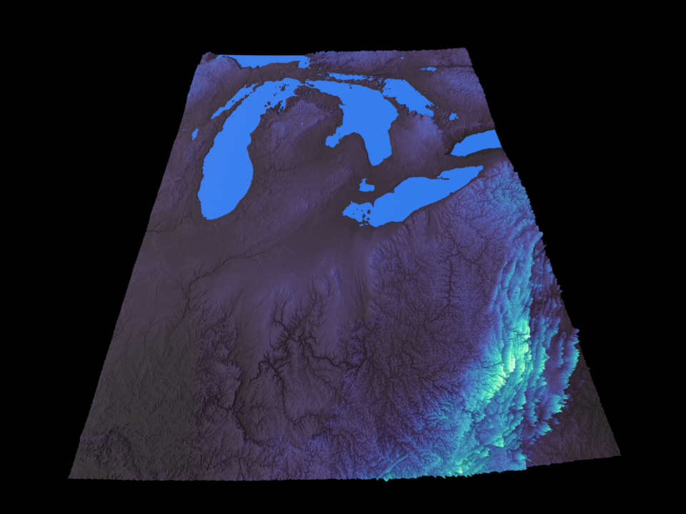
South View |
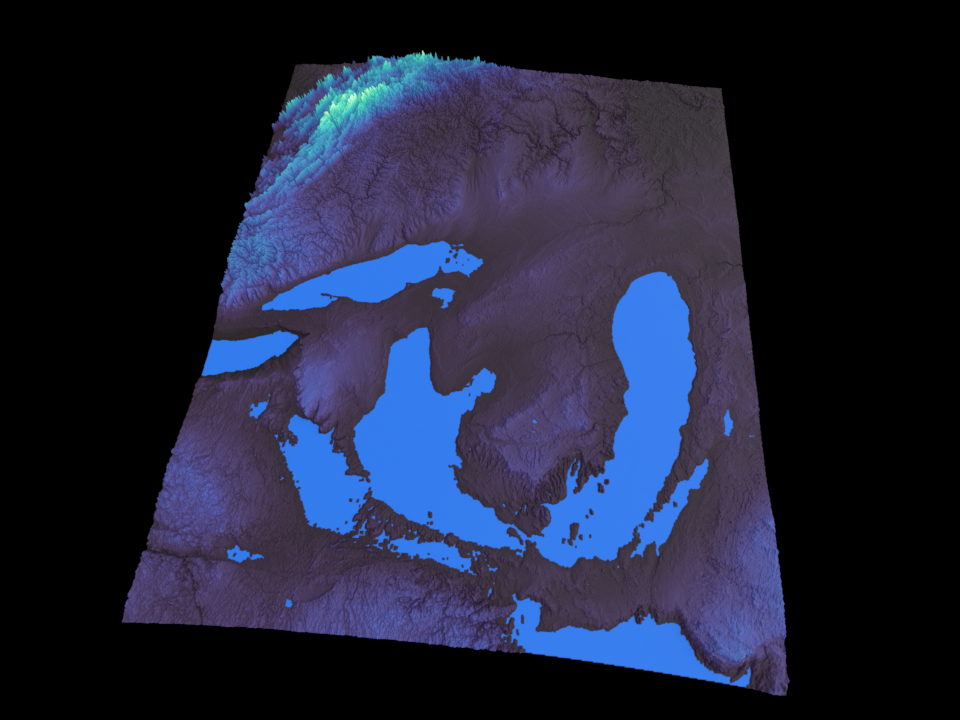
North View |
|---|---|
|
|
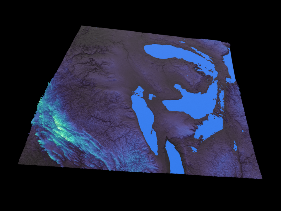
East View |
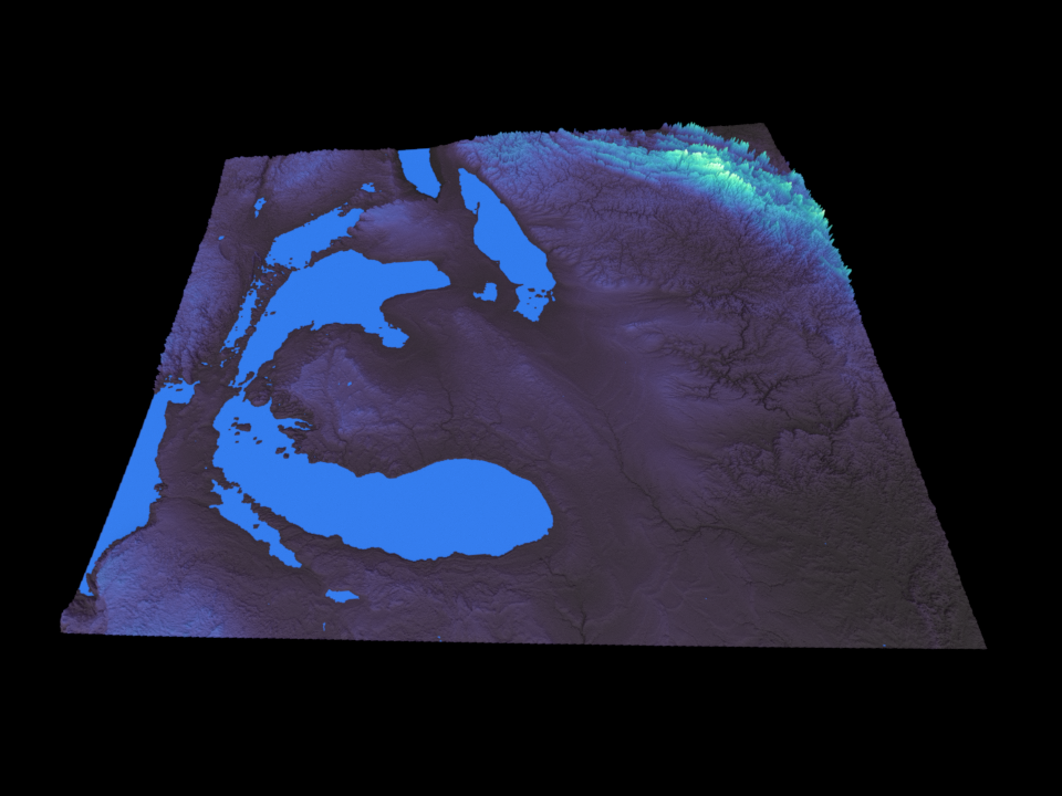
West View |
|---|---|
|
|
Overview
This example demonstrates:
Loading SRTM HGT elevation files
Reprojecting from WGS84 to UTM coordinates
Detecting water bodies automatically
Rendering with Blender
Quick Start
python examples/detroit_elevation_real.py --direction south
The Code
from src.terrain.core import Terrain, load_dem_files
from src.terrain.transforms import reproject_raster, flip_raster, scale_elevation
from src.terrain.color_mapping import elevation_colormap
from src.terrain.water import identify_water_by_slope
from src.terrain.scene_setup import position_camera_relative
from src.terrain.rendering import render_scene_to_file

# 1. Load elevation data
dem_data, transform = load_dem_files(SRTM_TILES_DIR, pattern='*.hgt')
terrain = Terrain(dem_data, transform)

# 2. Configure mesh density based on output resolution
WIDTH, HEIGHT = 960, 720
target_vertices = WIDTH * HEIGHT * 2
terrain.configure_for_target_vertices(target_vertices)

# 3. Apply geographic transforms
terrain.add_transform(reproject_raster(src_crs='EPSG:4326', dst_crs='EPSG:32617'))
terrain.add_transform(flip_raster(axis='horizontal'))
terrain.add_transform(scale_elevation(scale_factor=0.0001))
terrain.apply_transforms()

# 4. Set up color mapping
terrain.set_color_mapping(
    lambda dem: elevation_colormap(dem, cmap_name='mako'),
    source_layers=['dem']
)

# 5. Detect water bodies
water_mask = identify_water_by_slope(dem_data, slope_threshold=0.01)

# 6. Create mesh and render
mesh = terrain.create_mesh(
    scale_factor=100.0,
    height_scale=4.0,
    water_mask=water_mask
)
camera = position_camera_relative(mesh, direction='south')
render_scene_to_file("great_lakes_elevation.png", width=WIDTH, height=HEIGHT)
Key Functions Used
Function |
Purpose |
|---|---|
|
Main terrain processing class |
|
Load and merge HGT/GeoTIFF files |
|
Convert between coordinate systems |
|
Detect water bodies by slope analysis |
|
Smart camera positioning |
|
Render to PNG/JPEG |
Camera Views
Generate multiple views using cardinal directions:
python examples/detroit_elevation_real.py --direction north
python examples/detroit_elevation_real.py --direction east
python examples/detroit_elevation_real.py --direction above
Direction |
View |
|---|---|
|
Looking north (default) |
|
Looking south |
|
Looking west |
|
Looking east |
|
Overhead view |
See Also
Snow Integration: Sledding Location Analysis - Adding snow analysis
Combined Render: Full-Featured Example - Full-featured rendering
configure_for_target_vertices()- Mesh optimization